Belstone Tor
One very cold day in beginning February I was visiting Belstone Common. Belstone is a charming little village at the very north of Dartmoor, just southeast of Okehampton and the Common spreads out to the south of Belstone. Two rivers run north flanking the Common, East Okement River to the west and River New to the east. And in between rise several Tors.
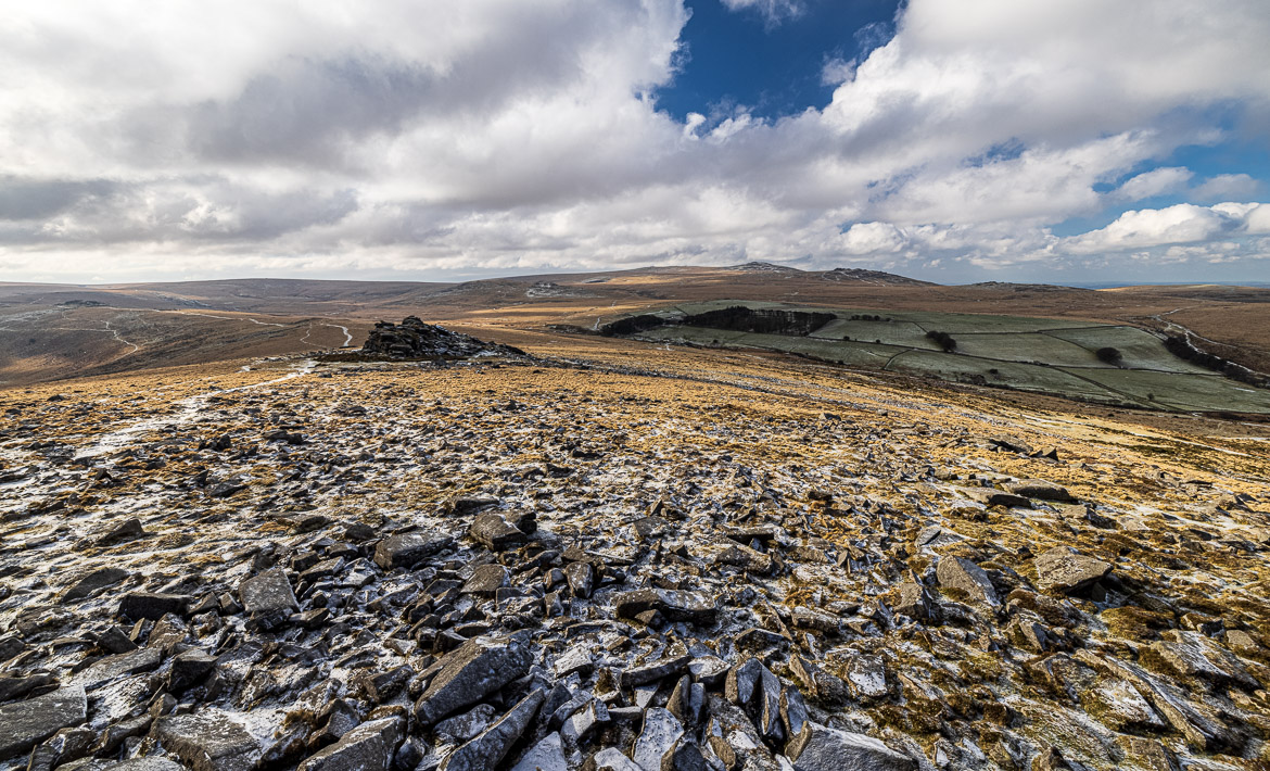
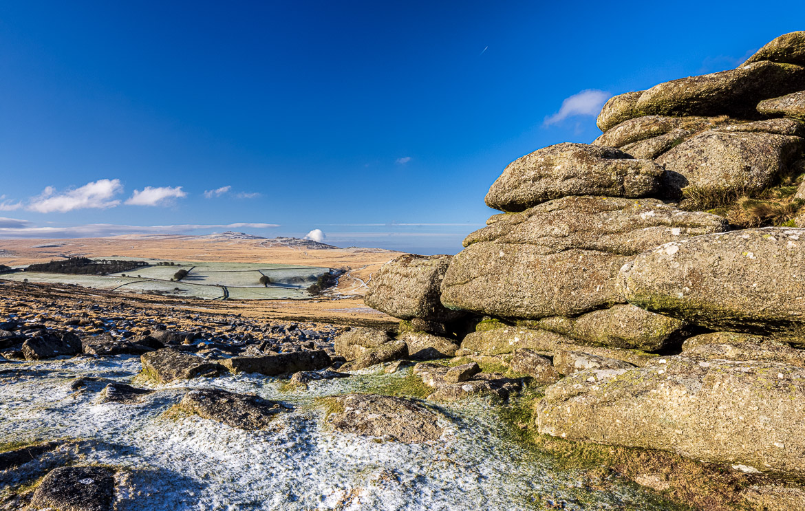
I had walked the area before to be able to find my way in the dark before sunrise and found the path up to Belstone Tor. But as the sun was rising a belt of dark grey clouds covered the Common, and although I could see the sunshine over Okehampton to the northwest, all the tors I wanted to be lit up by the rising sun were grey. Below here I publish one image taken from Belstone Tor that morning. You can see the blue sky and the sun shining over the farmland to the northwest, whereas the tor and nearby land is in shadow.
It was -5 degrees centigrade and very windy from the northeast, so I was trying to find lee behind the granite boulders waiting fo the sun to come out.
But I gave up and walked back down to catch The Nine Maidens, a Bronze Age cairn circle. It is actually a lot more than 9 stones and it is also known as The Seventeen Brothers. I counted to sixteen stones, and this burial chamber has certainly had more stones in the circle originally, than it now had.
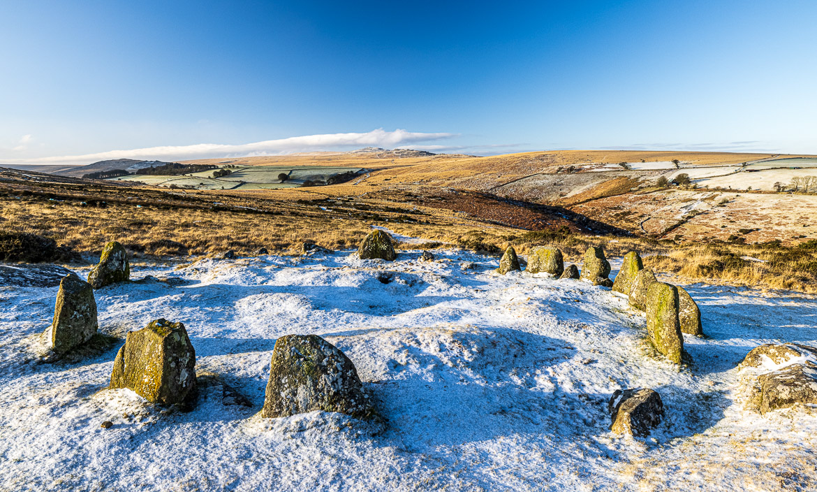
Down in the valley it was a lot warmer and less windy, and as I took out my camera the sun suddenly brought through the grey clouds and I succeeded in capturing the Maidens in sunlight. The legend tells us that they were originally 9 Maidens that were cast into stone for dancing on the Sabbath and condemned to dance every day into eternity as the bells of the nearby church are ringing.
Another etymological explanation is based on Phoenician tin traders that came to Dartmoor to get the tin. They worshipped the god of life and fertility, Baal, and the Phoenicians were said to have brought a large stone up to the top of Belstone Tor and the name Belstone could be a corruption of Baal’s Ton, or Baal’s Settlement.
While I was photographing the Nine Maidens and speculating where the remaining stones of this cairn were, the cloud cover retreated further and I decided to again walk up the hills to the top. On the way I past the LadyBrook Tor, the first outcrop of granite blocks on the ridge climbing up towards the top.
Looking out over the Moor to the southwest we have an expanse of vast open moorland with dramatic views of High Willhays and Yes Tor, which are part of military training ground, where Eric and I had met Mikee a few years back, when she finished the Ten Tors walk (a two day walk of 35 miles with 20 kg in her backpack with camping on the moor) as leader of her team.
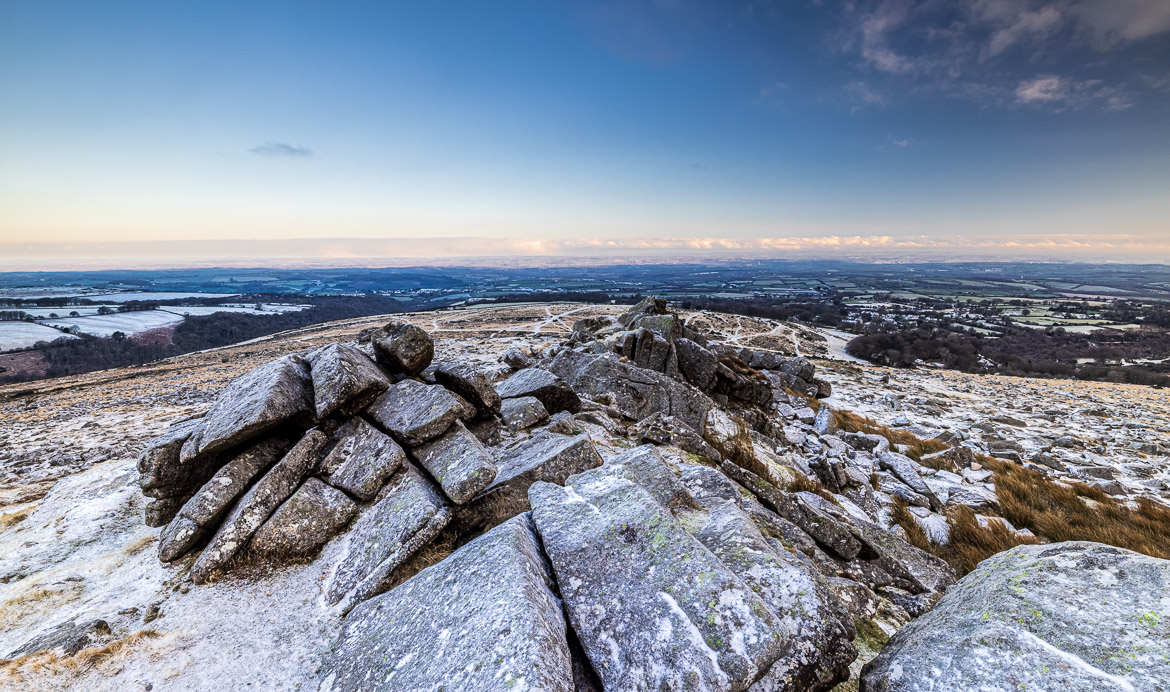
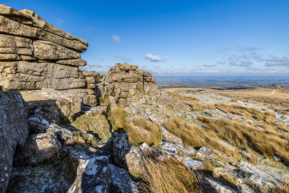
Continuing my walk south I passed Belstone Tor and a few hundred metres further south and 30 metres higher up I cam to Higher Tor. The wind was still howling, but at least the sun gave the impression of warmth. Unfortunately, every time I removed the gloves to set up my camera on its tripod, I was reminded that it was just an illusion. It was still bitingly cold.
The image below is taken from Higher Tor (at 480m altitude) looking towards Belstone Tor that can be seen at the very right of my image. And further down and hidden from the view are Ladybrook Tor and the Nine Maidens. Look at how the grass is bending in the easterly wind
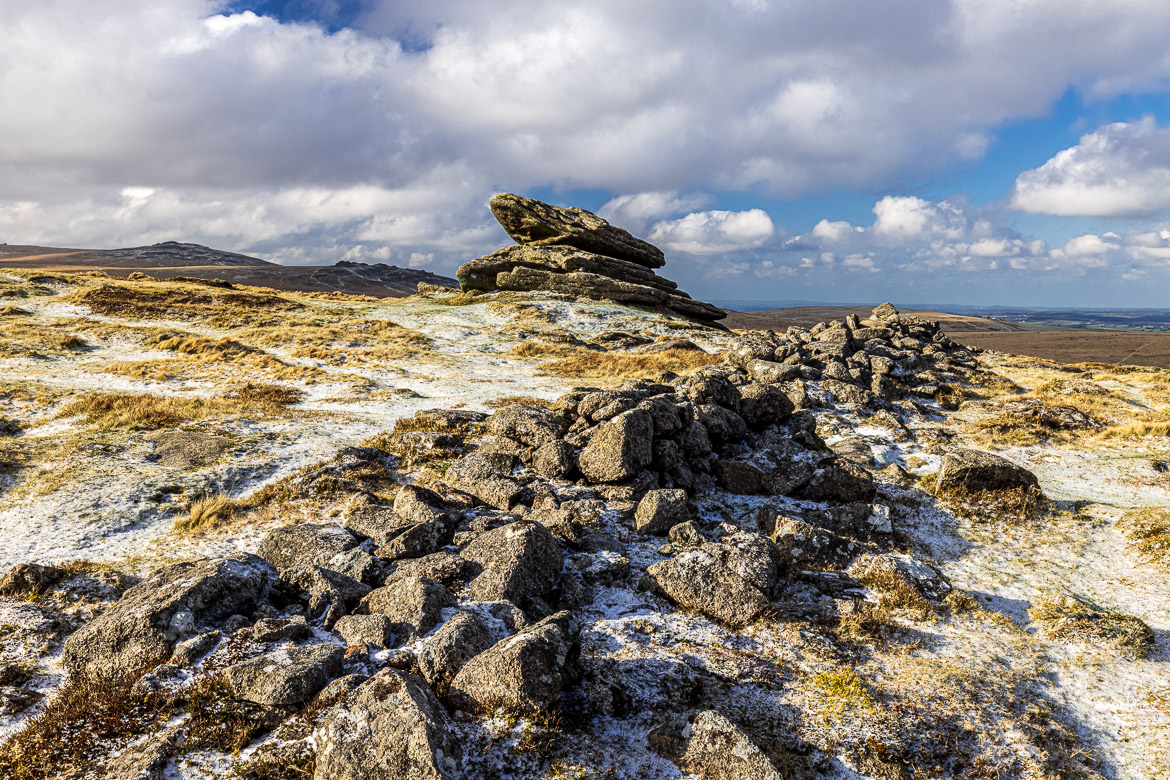
Continuing further south from Higher Tor the ground sloped down slightly, although I was still walking in the ridge with a biting wind and came to the Irishman’s Wall. Legend has it (as you notice, I have to rely on legend a lot as the facts are few and far between) that it was built by Irishmen to enclose part of Belstone Common and was torn down by the good men of Okehampton and Belstone. Part of it crosses the ridge just south of where my previous photograph was taken.
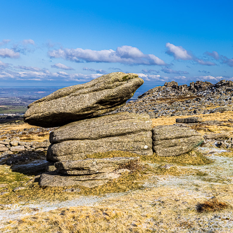
The Rabbit Rock in the background near the Irishman’s Wall. It is called so, because it looks like a rabbit, although I walked around it and my imaginations wasn’t good enough to imagine the rabbit, who should be seen with ears and all. See my two photos below.

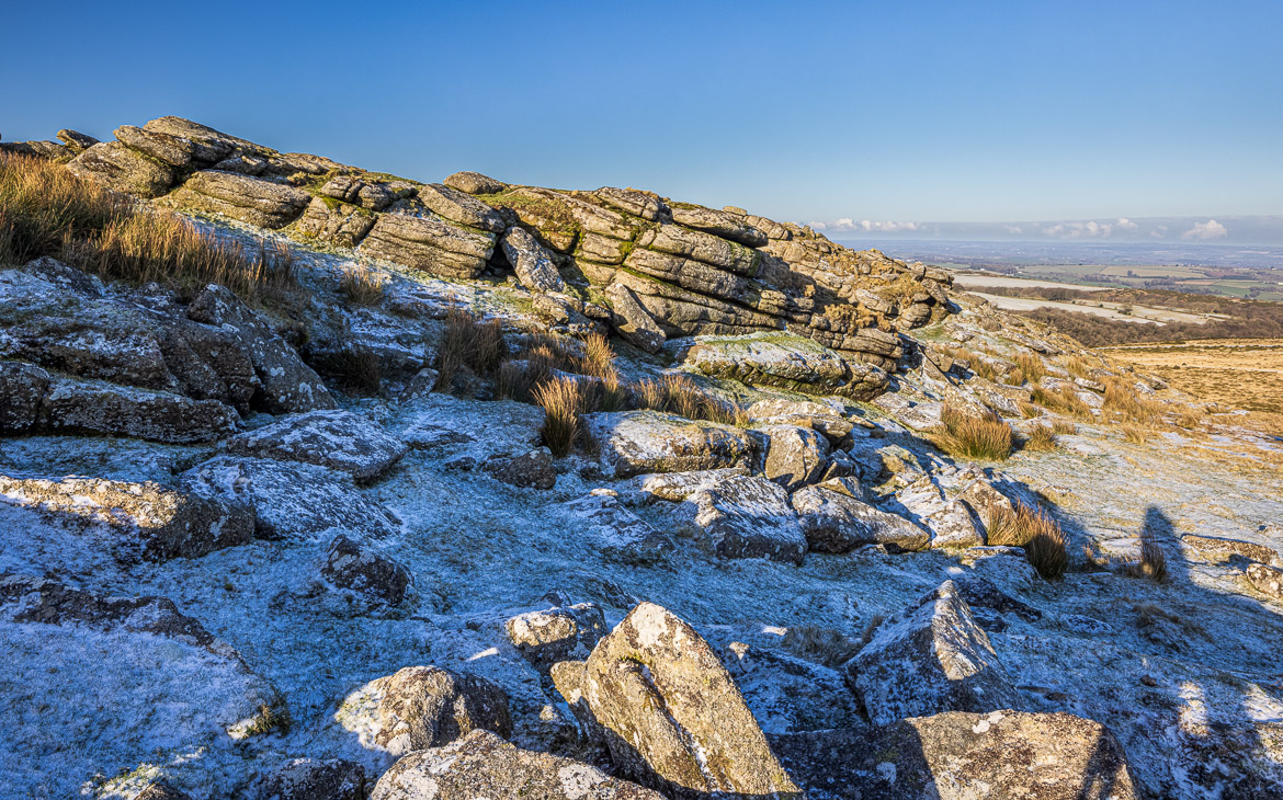
Continuing our walk south along the ridge we come to a steep part looking south and southwest towards the two tall hills in the background again, Yes Tor and High Willhays (both at around 600 m altitude). It was lots of clitter in the foreground. The small stones make the walking and climbing sometimes difficult, but doesn’t stop you.
As you can see the clouds have built up again and soon after this picture the moorland was in shadow again for the remainder of the day.