Clapper Bridges and Leats on Dartmoor
Clapper bridges are built by large flat slabs of stone, mostly granite, supported by stone piers or by the banks of streams and rivers. They were mostly erected in medieval times and mainly built for people and packhorses, but a few are larger to take small carts. They are found on the moors and in other upland areas in the UK crossing over rivers or streams or manmade leats.
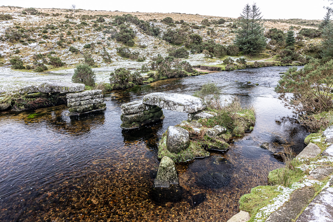
The slabs can be quite large. The ones at Postbridge (see image above) are over four metres long and each slab has a weight of over 8 tonnes. And others are tiny leading across small streams or leats (see below). The clapper bridges are mainly found on Dartmoor, where there are more than one hundred of them, but there are in other upland areas around Great Britain like Snowdonia and Yorkshire too.
Most of the clapper bridges were erected in medieval times although some are newer. The word clapper derives from the Anglo-Saxon word cleaca, meaning “bridging the stepping stones”. This indicates that the first clapper bridges may have been formed of naturally occurring stepping stones, which were covered with flat slabs to make it easier to cross the river.
Clapper bridges is a photography project of mine in the making! There are, as I said, on Dartmoor more than 100 clapper bridges, and when the pandemic is only a distant memory , the weather improves, and the leaves come back on the trees at springtime, I want to go back and find and capture more of these clapper bridges!
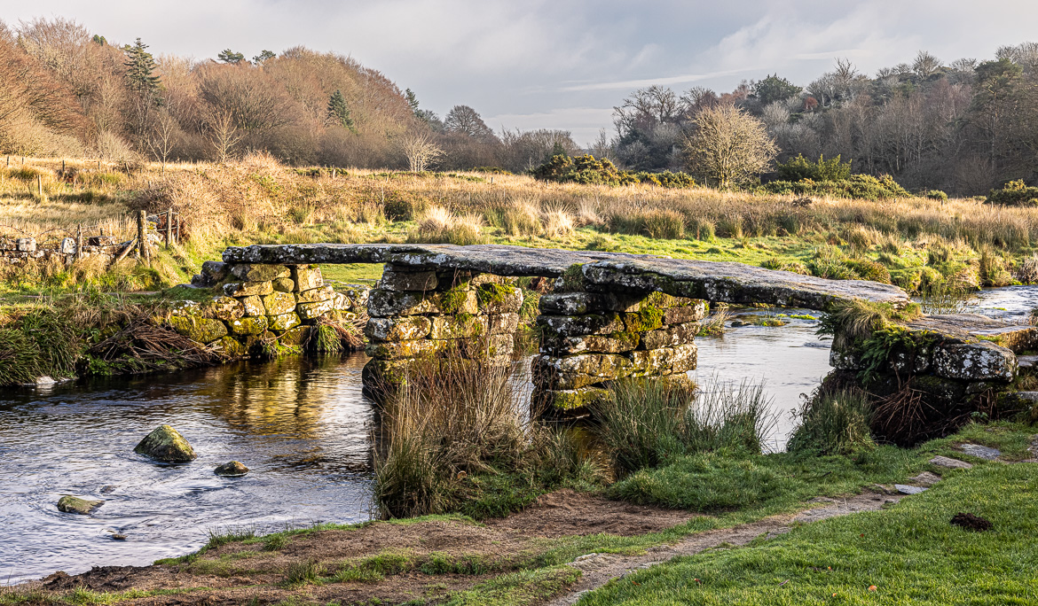
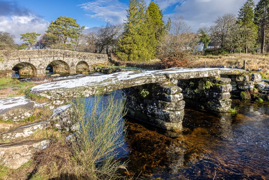
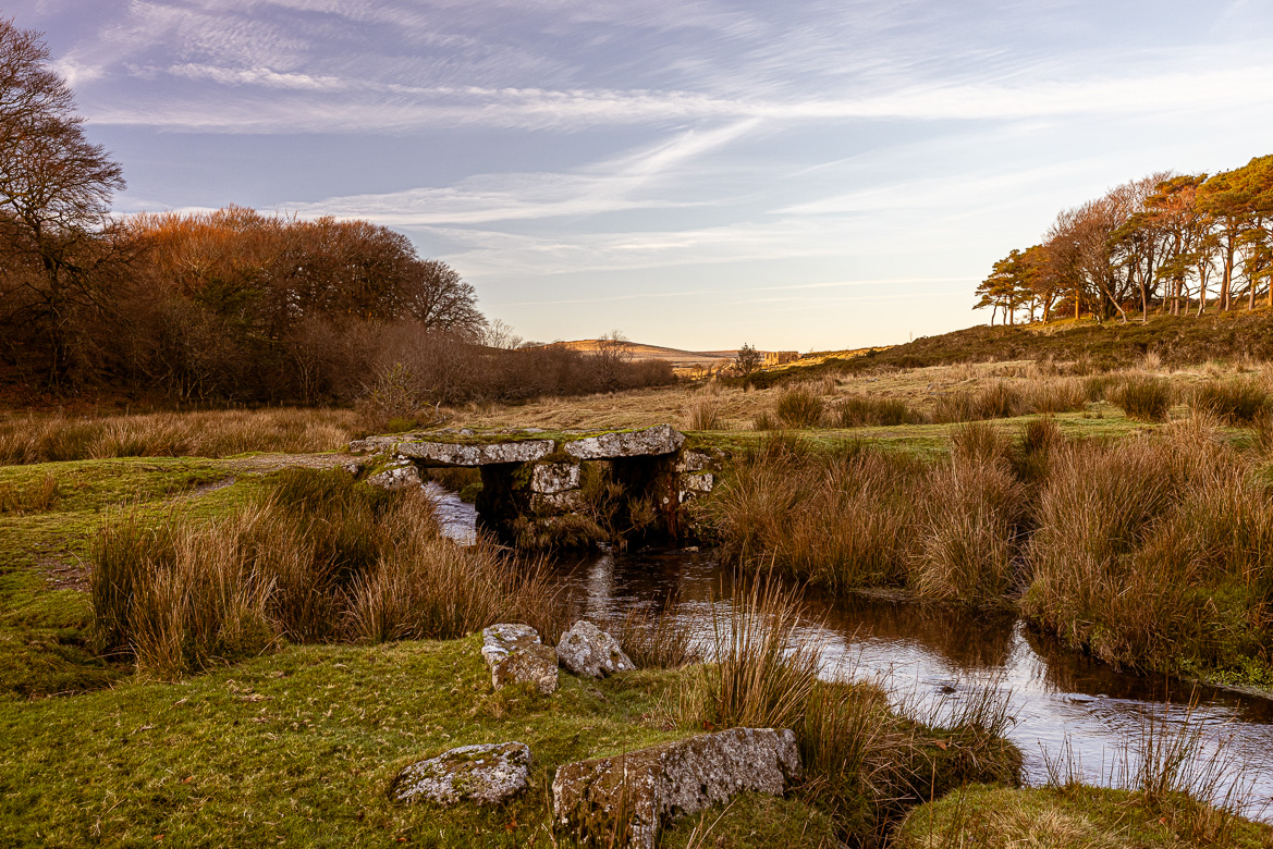
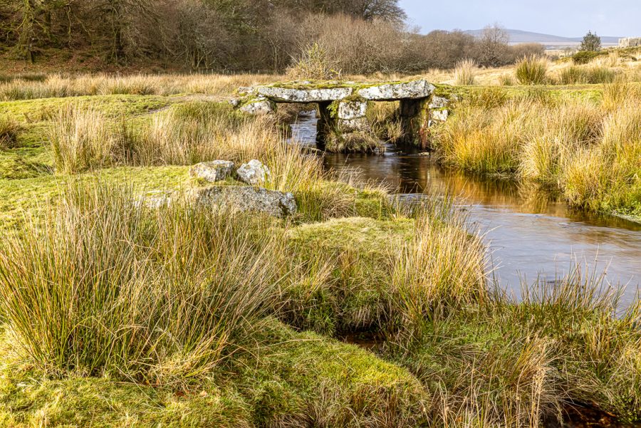
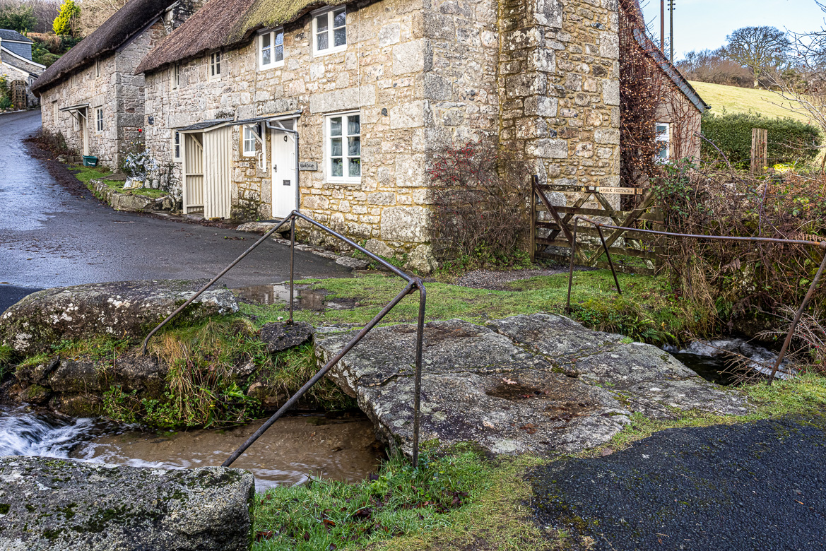
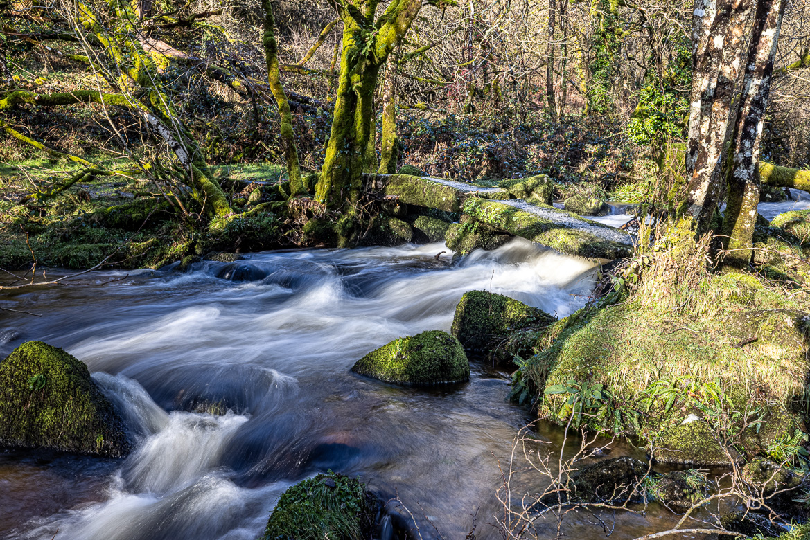
Postbridge
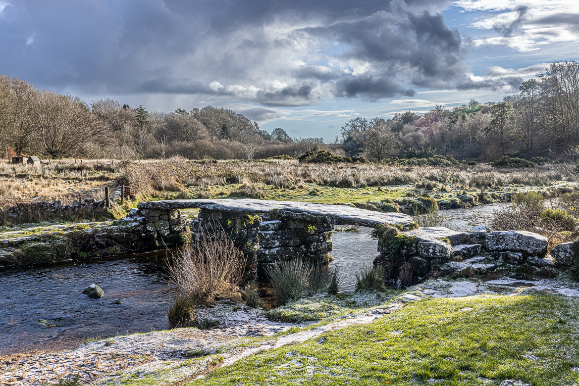
The Postbridge Clapper Bridge is a fine example of a bridge still standing. It was built for the transportation of Dartmoor tin by packhorses and is situated in the middle of Dartmoor. Underneath the thin layer of soil, most of Dartmoor consists of granite and sometimes with tin mixed in. Already in pre-Roman times tin mining existed on Dartmoor and it continued until 1930, when the last tin mine closed. From the tin mines on Dartmoor the tin was processed in tannary towns, and across Postbridge clapper bridge it was transported on horseback to such a tannary town – Tavistock in West Dartmoor.
The clapper bridge at Postbridge is believed to have been built in the 13th century. Postbridge is a small hamlet near the bridge. The large stone slabs are locally called posts, and that is how the little village got its name. The slabs are more than 4 metres long and 2 metres wide and each slab weighs around 8 tonnes. The total span of the bridge is 42 feet or 12.5 metres.
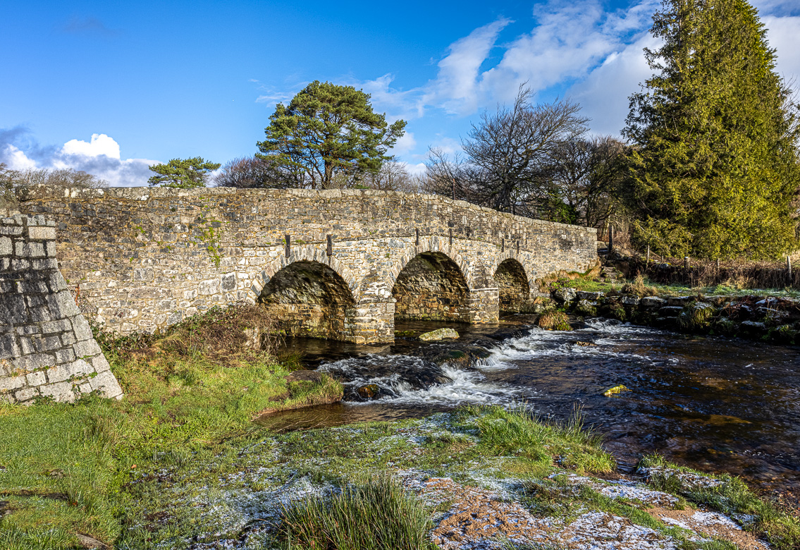
Nearby a new bridge was built in the 1780s. To me the new bridge is also very attractive with two piers with pointed cutwaters. I was capturing the clapper bridge with the tripod set on the parapet of the new bridge.
Postbridge is definitely the most photographed clapper bridge on Dartmoor. It is very beautiful, but the main reason is that it is so accessible, situated only a few metres away from the new bridge and road, so many tourists stop for the selfies with the clapper bridge in the background.
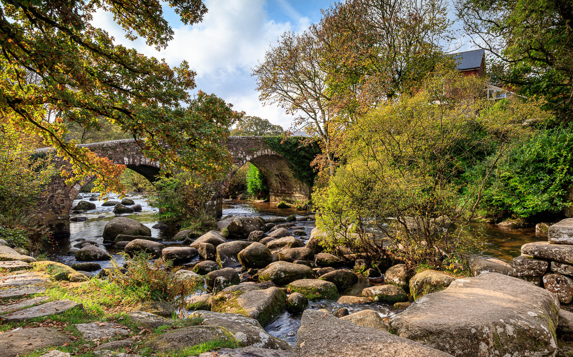
Dartmeet
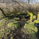
Dartmeet is where the two main tributaries of River Dart meet up. Just before the meeting point a medieval clapper bridge crossed the East Dart River. The clapper bridge has now partially fallen in, but the stone piers and a couple of the clapper stones remain. This is the case also with other clapper bridges. The one in Bellevere (see further on) has also collapsed.
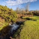
Nearby, just like in Postbridge, a new bridge was built in 1790. The image above shows the clapper bridge captured from the new bridge, and the image below shows the new bridge captured in mid October, with the leaves still remaining on the trees. The remains of the clapper bridge can be seen at the bottom right of that image. With heavier traffic the old clapper bridges where no longer satisfactory and I found at many places a new bridge nearby replacing the old clapper.
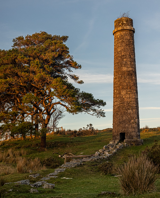
Cherry Brook Powder Mills
In the middle of Dartmoor is an old disused Powder Mill built alongside Cherry Brook. Until dynamite was discovered (by the Swedish inventor and industrialist Alfred Nobel) in 1867, gunpowder was the only explosive available for military use as well as for blasting in mines and quarries.
The reason for the location in the southwest was both the military need (big naval bases) and the mining industry. And Dartmoor offered areas, where the buildings for producing gunpowder could be spread out to minimise risk of damage to people. Due to the design of the whole complex, no person ever died during the factory’s operation although several explosions occurred.
Several buildings were erected, most of them containing machinery, which was powered by water from the nearby Cherry Brook and East Dart rivers. Powder Mills was operational from 1844 and until 1897. In total 18 buildings existed situated on both sides of Cherry Brook. Crossing the river several clapper bridges connected the paths.
In my photos below I have also included a chimney built far away from the powder mills to avoid any explosions.

The same clapper bridge another day 
Furnaces and chimneys were placed far away from the buildings for manufacturing of the gun powder to avoid explosions
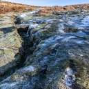
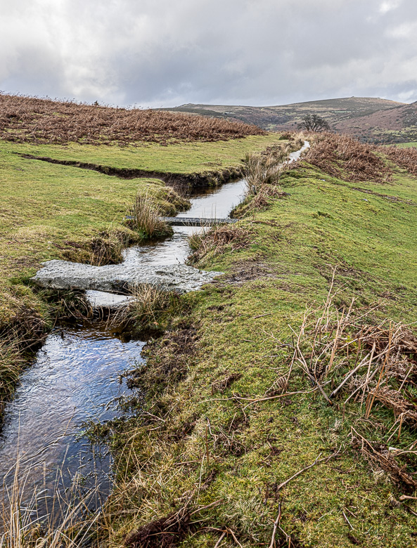
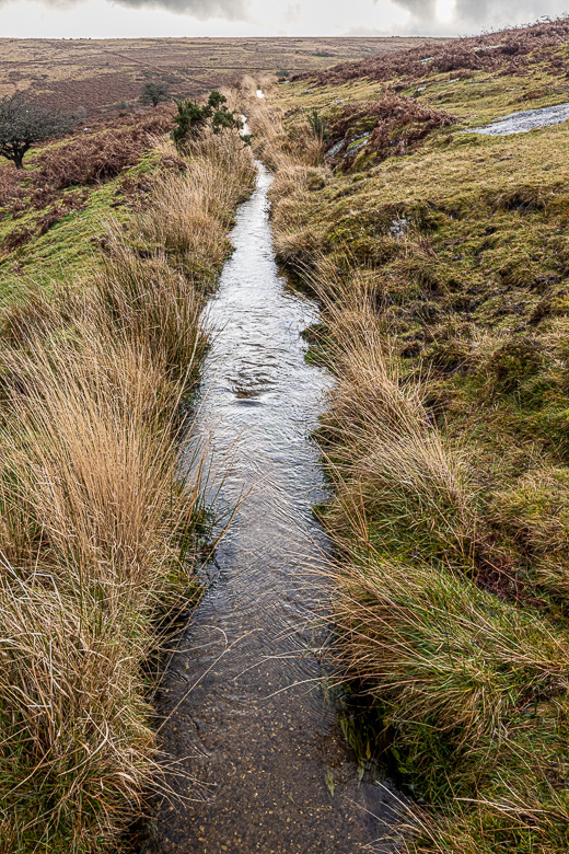
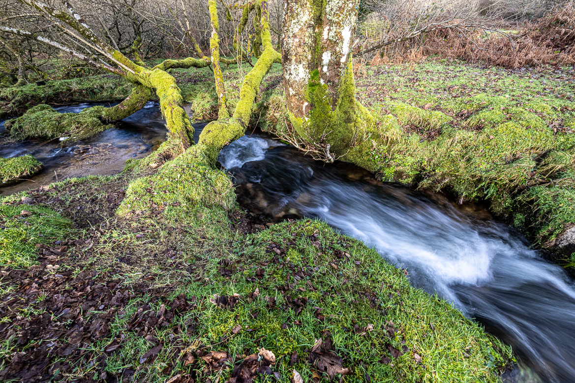
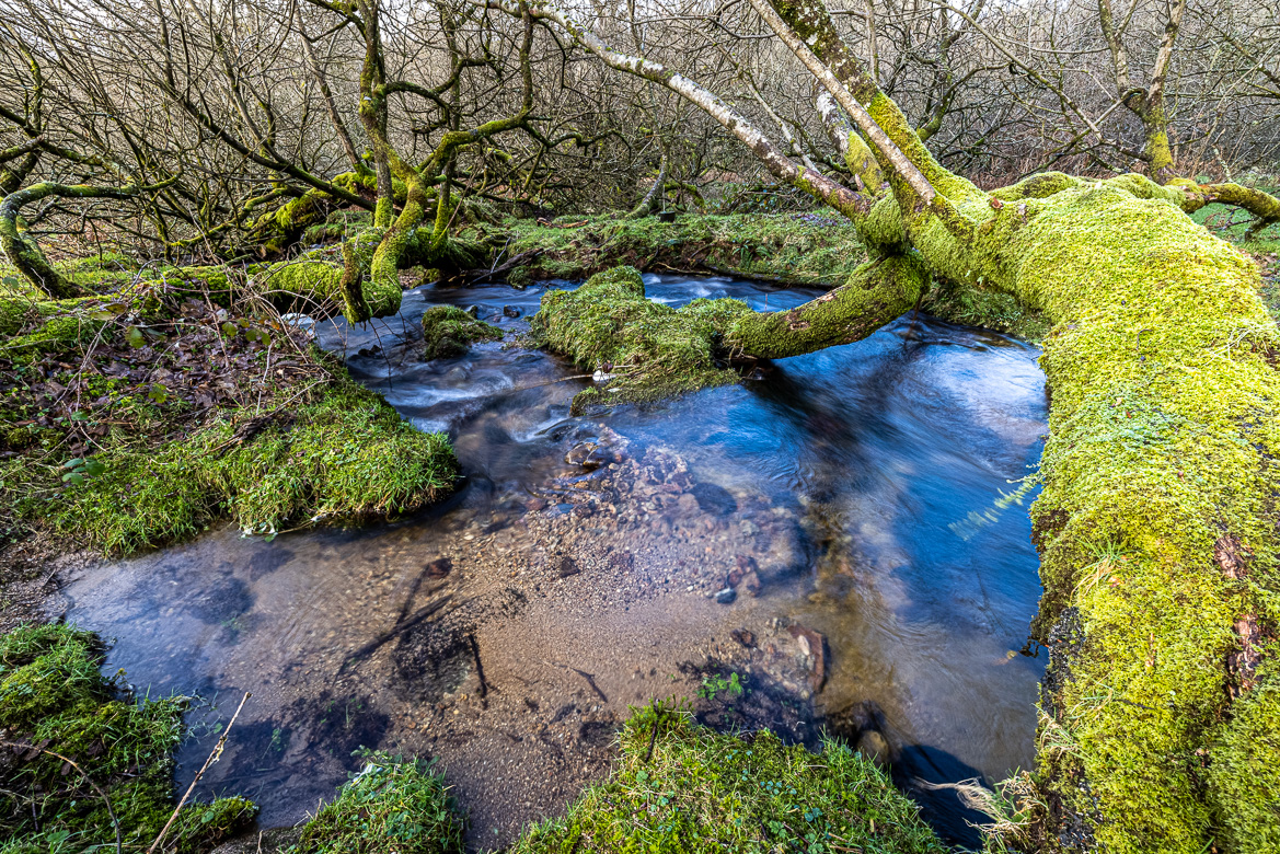
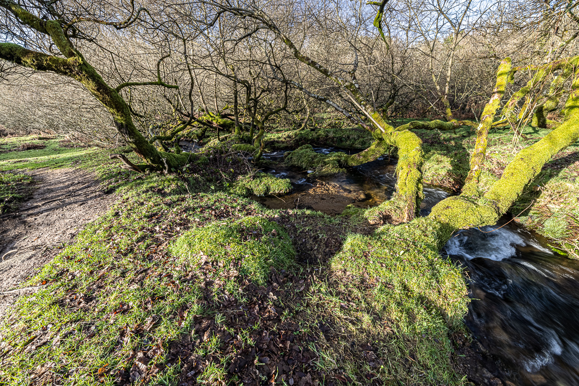
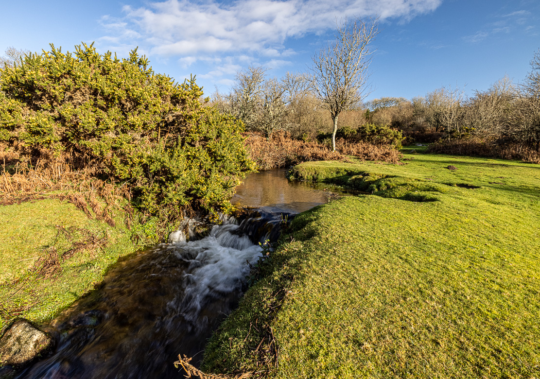
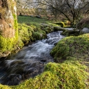
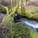
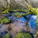
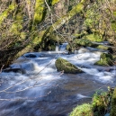
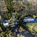
Holne Moor Leat
Holne Moor is situated just south of the River Dart after the West and East Dart Rivers have merged at Dartmeet. A leat is the name in southwest England for an artificial water course dug into the ground. It is a small canal or sometimes more like a ditch, often dug to supply water to a water mill, but could also be for drinking water.
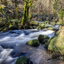
The leats are slightly sloping down to use gravity to transport the water, but in order to transport it long distances the slope must be minimal, so the leats follow the contours of the terrain on the moors. The images below show the Holne Moor Leat west of the small village of Holne.

Another part of the same leat with a clapper bridge in the foreground and behind is a simple wooden plank 
The leat has been dug out into the moor to transport water. In this case along Holne Moor to the Venford Reservoir
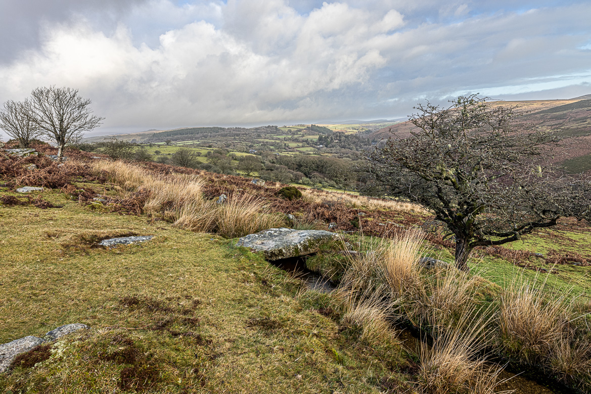
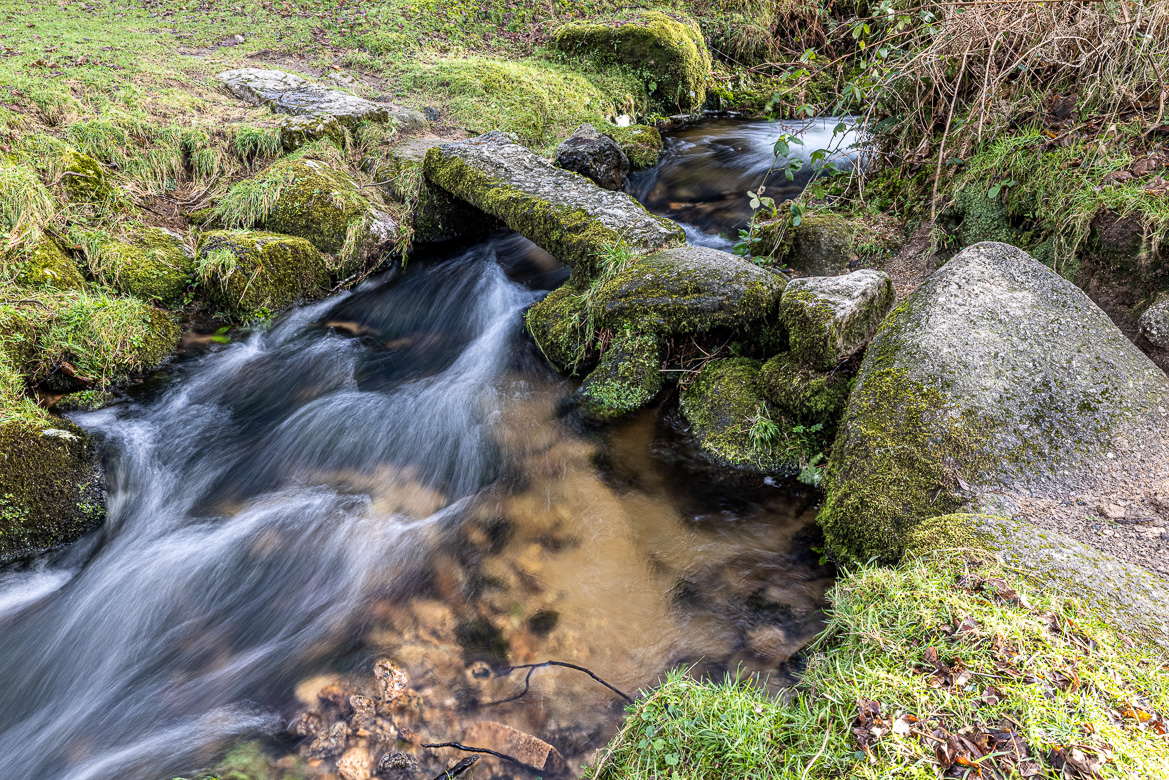
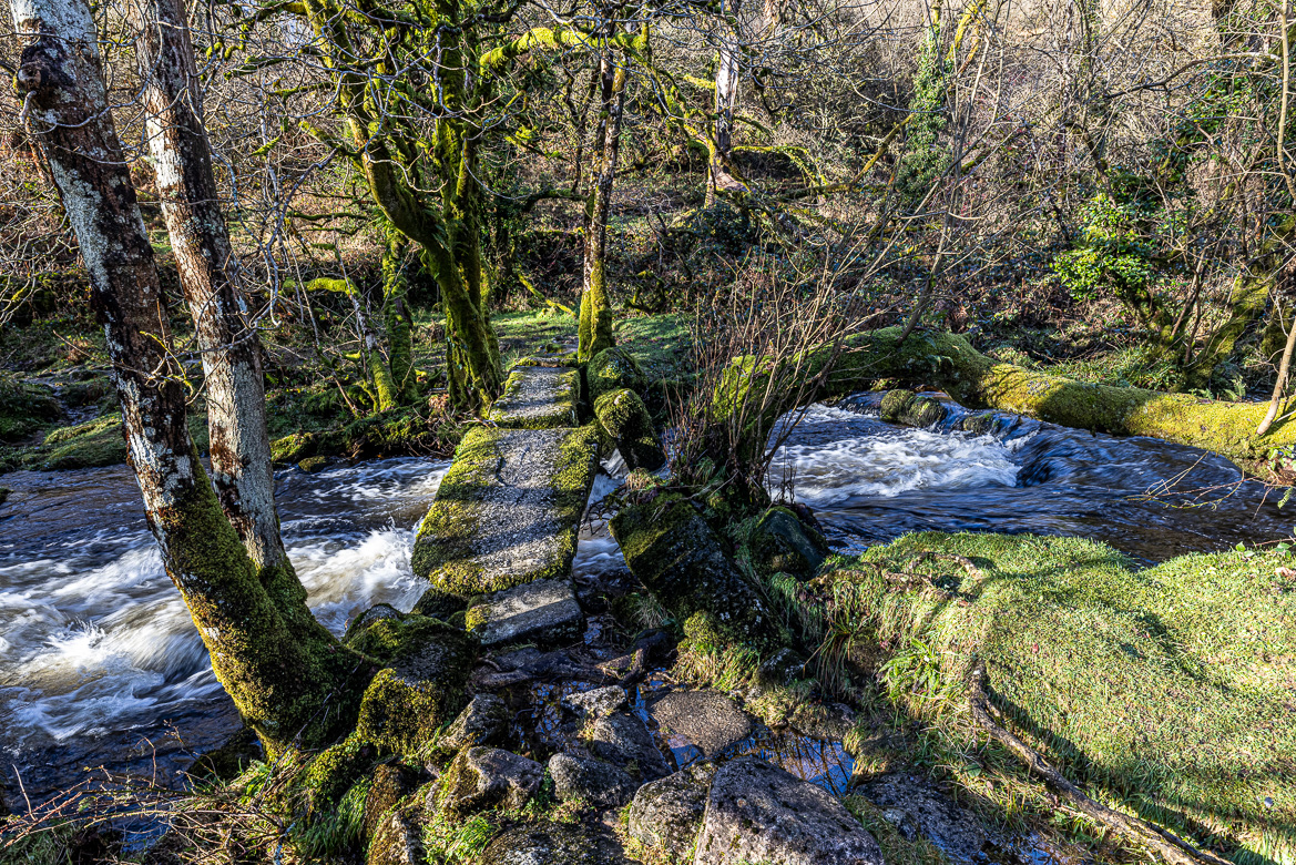
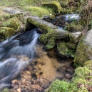
Aller Brook Clapper Bridge
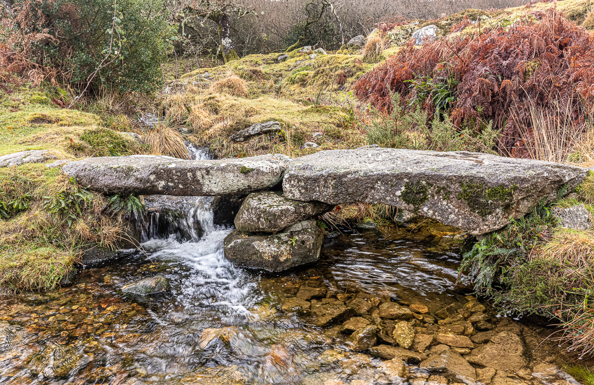
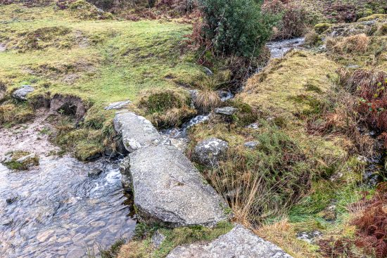
At Combestone Woods I discovered a little clapper bridge crossing a stream. I had to search hard until I found a name for the stream on a map. It is called Aller Brook and the bridge is Aller Brook Clapper Bridge. The foot path I walked along came from stepping stones across the West Dart River near Dartmeet and took me along the river increasing in altitude around 150 metres until I ended up at a road near Venford Reservoir. And the crossing of Aller Brook was roughly halfway on my walk.
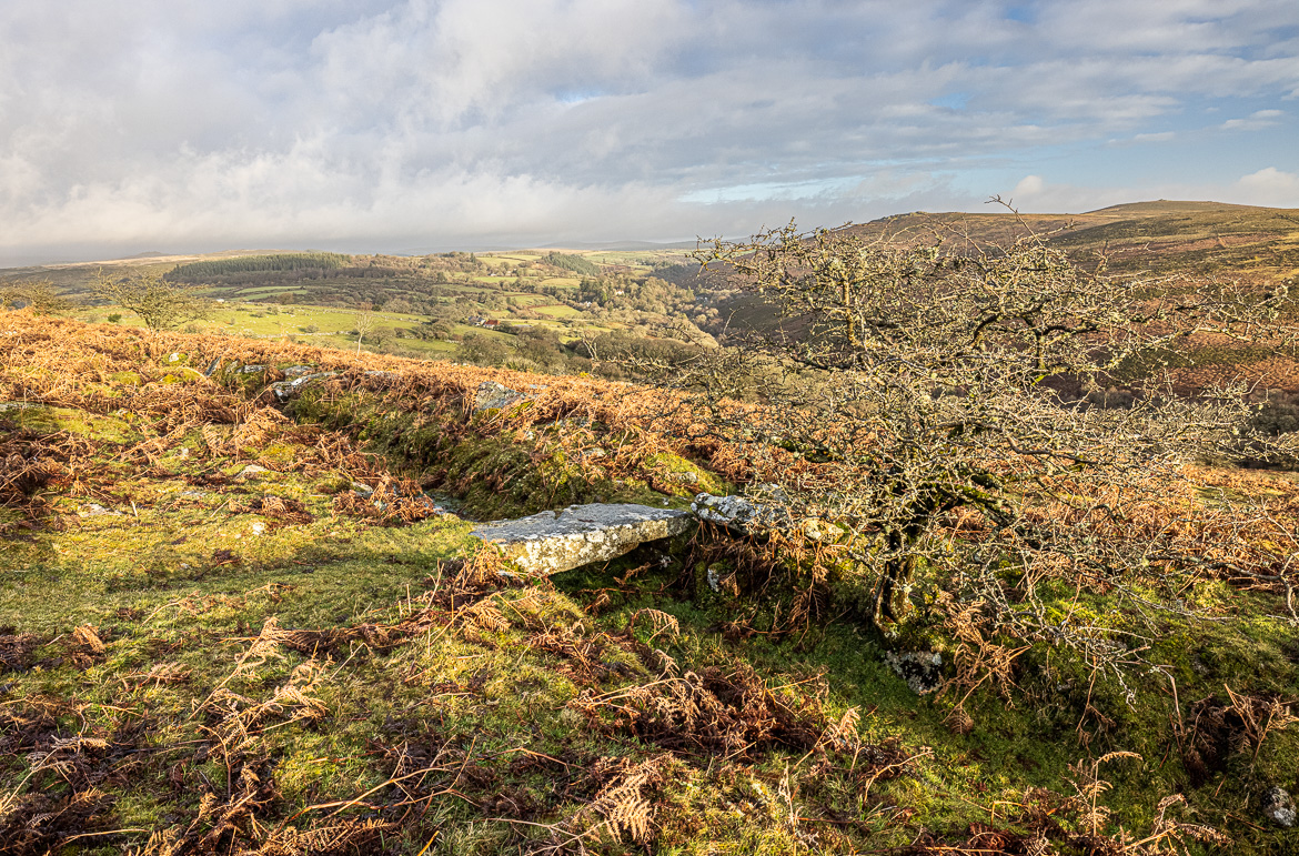
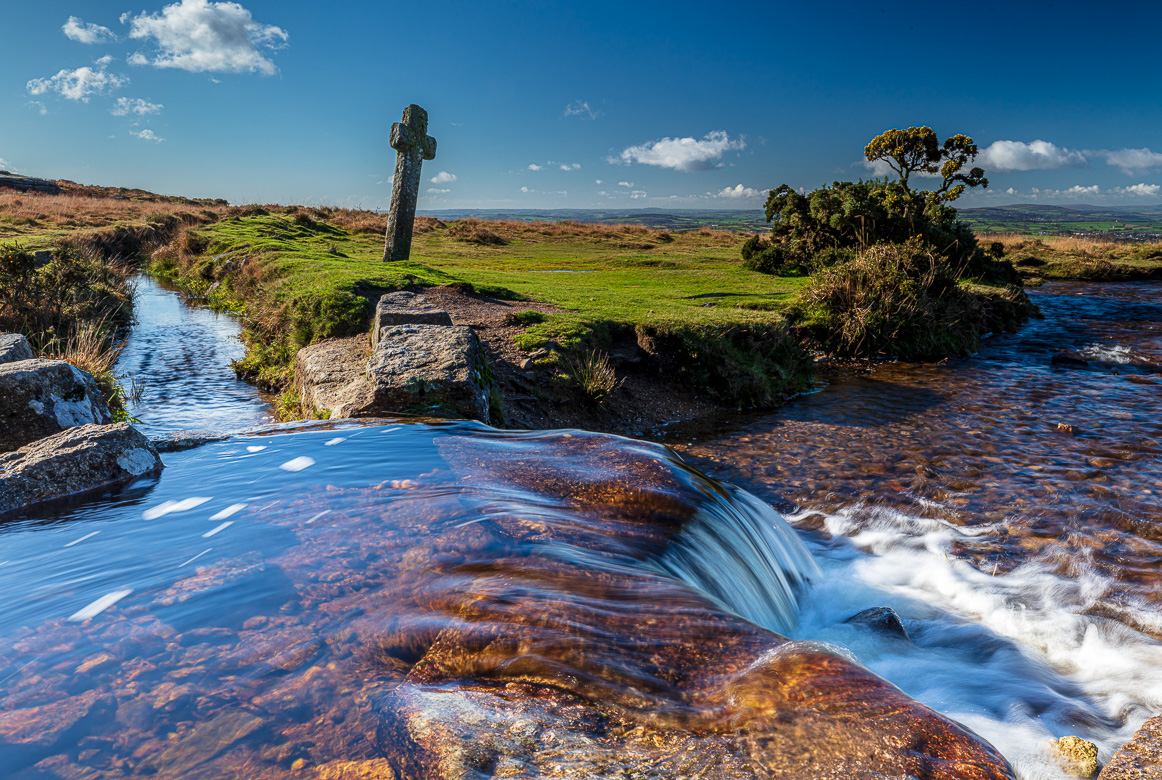
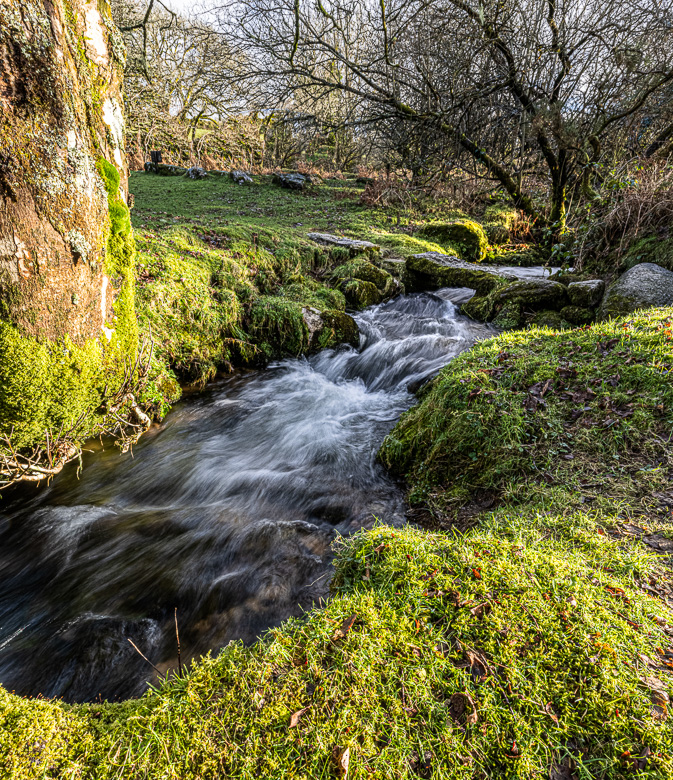
Grimstone and Sortridge Leat at Windy Post
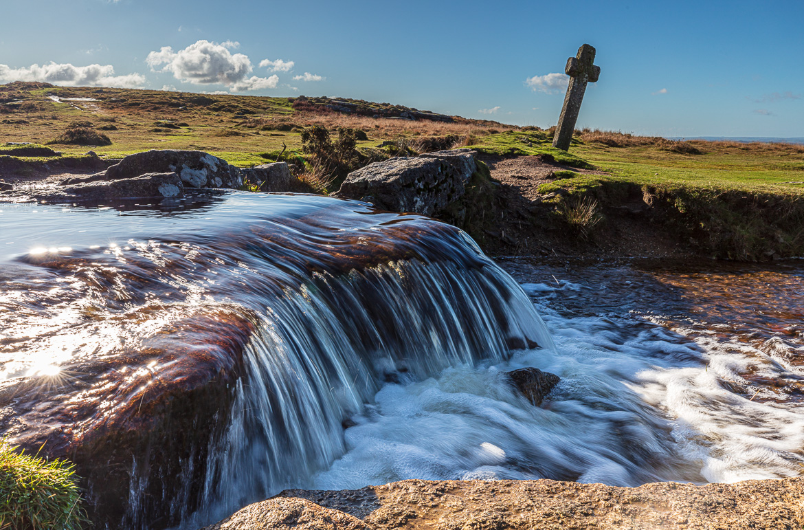
Grimstone and Sortridge Leat is another manmade leat or canal constructed more than 700 years ago. It carried water to the manor houses of Grimstone and Sortridge and still supplies drinking water to around 35 houses.
At the leat there is a very attractive but also very small waterfall, and next to the waterfall is a granite cross leaning towards one side. The cross is called Windy Post, suggesting it has been blown aside causing it to lean. That is probably not the case. It is more likely that cows or sheep have pushed it aside. Its correct name is Beckamoor Cross.
The cross was erected in the 15th century, probably replacing an earlier one. It has likely been used as a marker on the monastic route between Buckfast and Tavistock Abbeys.
Ponsworthy Clapper Bridge
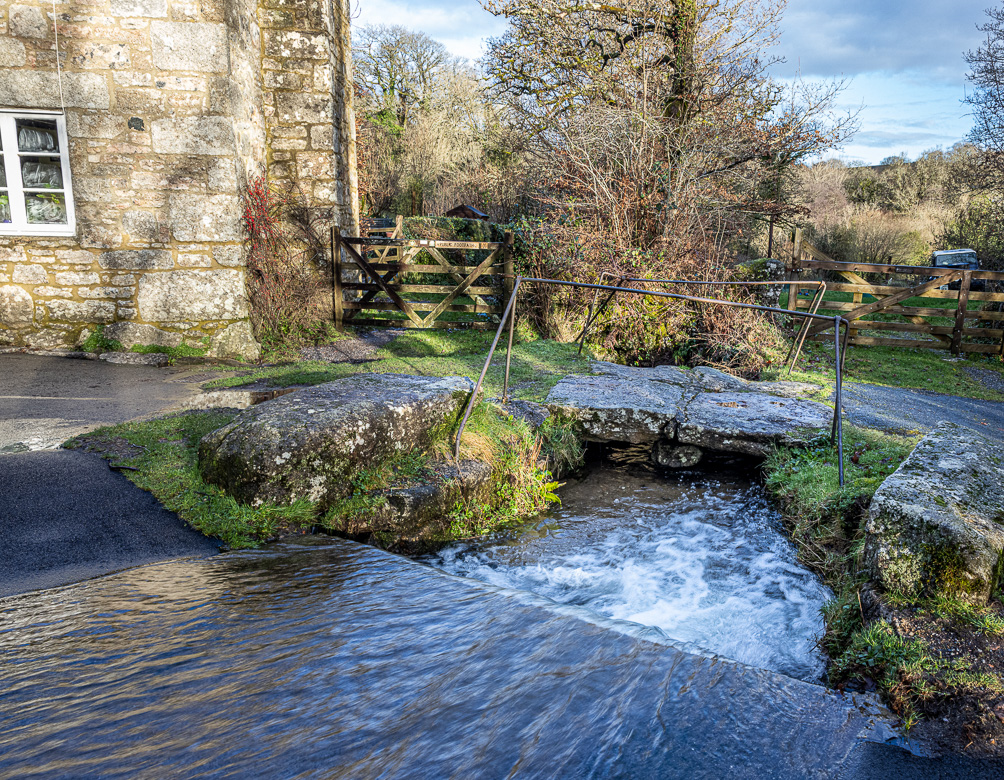
I was driving from Widecombe-in-the-Moor to Babeny along the Two Moors Way (connecting Exmoor and Dartmoor and originally only a bridleway, but now possible to drive by car), and at the turnoff near Ponsworthy I passed a small clapper bridge alongside the ford I was driving across. The little stream underneath the clapper bridge merges into West Webburn river 150 metres further down, and I had just passed the narrow bridge (well, all bridges on Dartmoor are narrow!) over Webburn river and turned off to the right, when I spotted the clapper bridge.
The first image above I saw as I passed with the car and the second, below, I captured, when I walked back after having found a temporary parking spot. The bridge is still very much in use by the villages as the alternative is to wade across the stream.
Walla Brook

There are actually several Walla Brooks on Dartmoor. This one merges into East Dart River just south of Babeny. I had a walk from Babeny following a tiny stream (I couldn’t find any name for the stream, although I searched widely on maps and on the net) until I came to Walla Brook and followed the Brook south until it met East Dart River.

Near Babeny the path crossed the little (unnamed) stream and I found another tiny clapper bridge, only a single clapper stone supported by two stones, one at either side of the stream. And then it continued along the moor and in the dwarf-like forest until it met Walla Brook. The clapper at Walla Brook was difficult to catch with my camera as it was a jungle of trees surrounding it and preventing a clear view.
On the other side of Walla Brook the path continued down to the East Dart River, where it should be a series of stepping stones I wanted to capture. But unfortunately it had rained so much that the Brook had raised and covered the path and I decided to turn back before I came to the stepping stones. I have illustrated my walk with the little slide show underneath here.
Slide show: Walla Brook
Click on the arrows to advance the slide show.

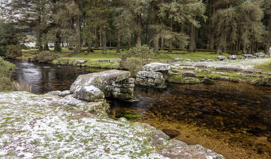
Bellever Clapper
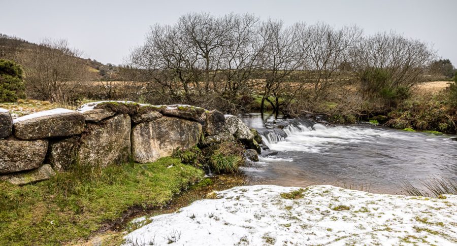
Bellever is a tiny settlement on Dartmoor at East Dart River. A road crosses the river and near the more modern bridge are the remains of an old clapper bridge. Also nearby is a weir, a small manmade dam in the river. I visited on the 2nd of January, when the ground was covered by a tiny sprinkle of snow.
The bridge consisted originally of four slabs of stone supported by three pillars or posts, but two of the slabs have disappeared. It is difficult to know exactly how they could have just vanished from the bridge. The slabs are weighing several tonnes each and where have they gone?
A pine tree forest was planted here in the 1930ies. There are lovely walks along the river and inside the forest. Part of the coniferous plantation can be seen in the image below. Close to the clapper bridge is a weir, a dam in the river before it reaches the bridge.

The weir near Bellever Clapper Bridge 
Bellever Clapper Bridge across East Dart River. Bellever Pine Forest in the background
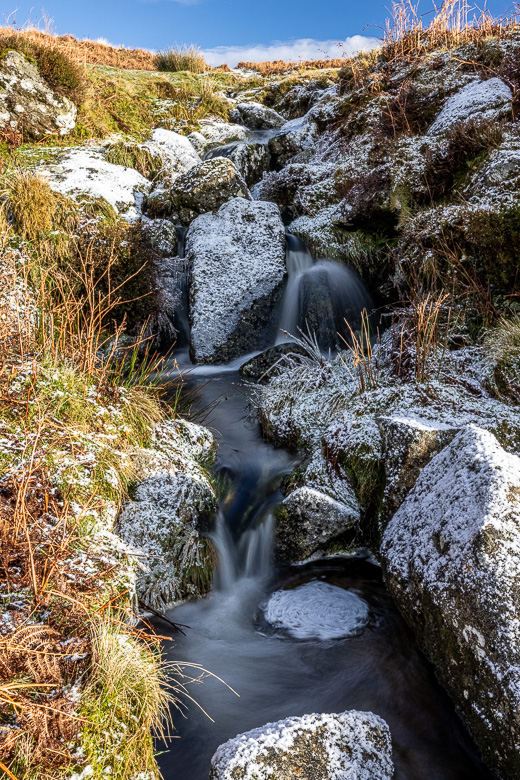
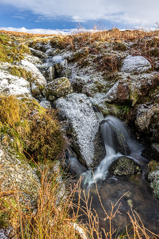
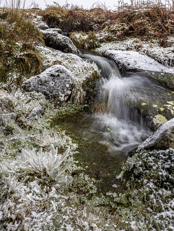
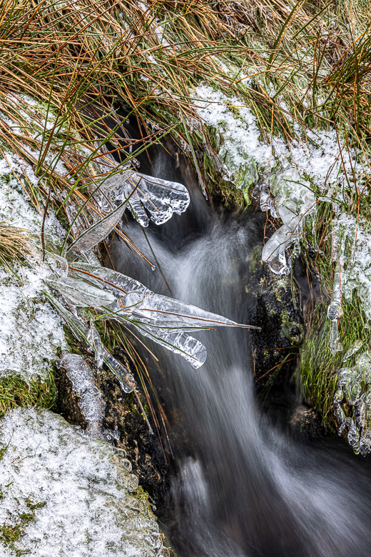
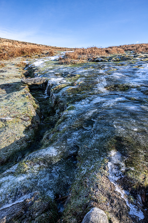
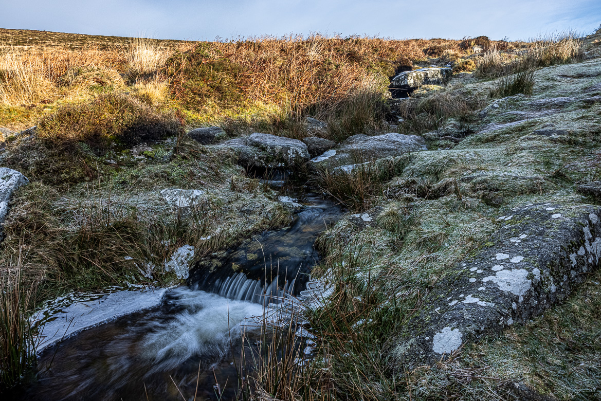
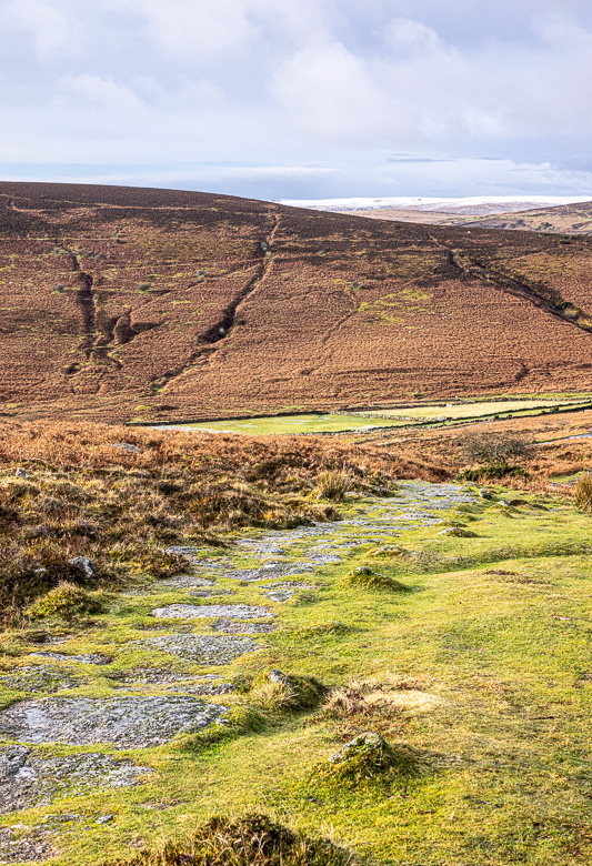
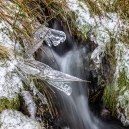
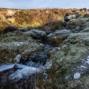
Grim’s Lake
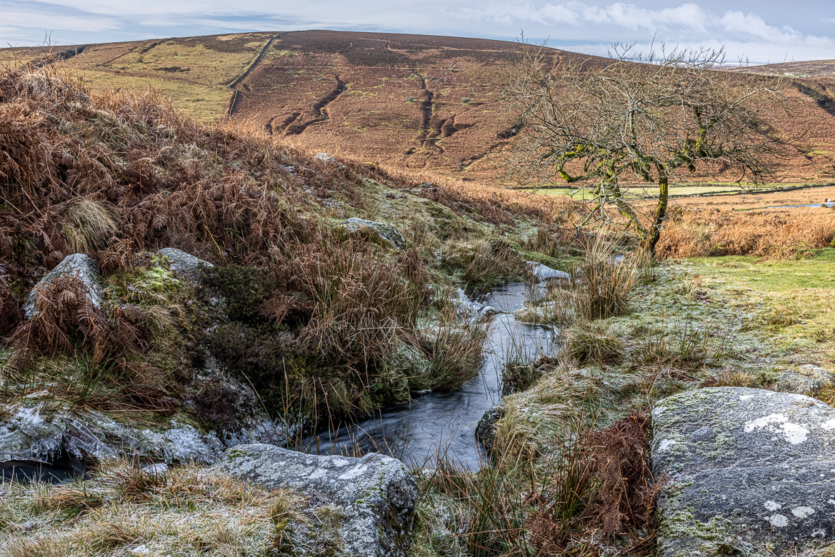
Grimspound is an old settlement (now uninhabited) at the north part of Dartmoor on Hookney Moor. It consists of 24 hut circles and a large wall surrounding the whole complex. It was named Grimspound, by a Reverend Polwhele in 1797. Several speculated that it was originally inhabited by Vikings, as they found artefacts seemingly supporting that theory, but Grimspound was built in the Bronze Age by the Anglo-Saxons.
Straight through the walled settlement runs Grim’s Lake, which contrary to what the name may give the impression of, is a tiny stream, not a lake. Near Grimspound is an old tin mine, and several footpaths cross the area, originally being used by tin miners and cattle herders and now loved by Dartmoor ramblers. One of the paths follows the Grim’s Lake towards Grimspound and crosses it using a couple of clapper bridges.
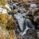
I was there on a couple of frosty days to photograph the clapper bridges, but I also walked up along the stream and captured it with some water splashed upon tiny grass straws coating them with icicles and beautiful formations of different kinds. See the slide show below here.
Slide Show: Grim’s Lake
Click on the arrows to advance the slide show.