There are four true deserts in the USA, The Great Basin, Mojave, Sonoran and Chihuahuan. The Great Basin is by far the largest covering parts of Oregon and Idaho in the North, Utah and Nevada as well as a small portion of north-eastern California. The Colorado Plateau, the large sandstone plateau that occupies a large part of Utah and northern Arizona, is a part of the Great Basin . Zion Canyon, which I described in a recent post, is situated in the westernmost part of the Colorado Plateau.
Mojave Desert is located south of the Great Basin and is what most would regard as a typical classic desert: Low rainfall and some very hot weather. The most famous part of the Mojave Desert is without doubt the Death Valley, the largest National Park in the USA outside Alaska.
After we had been to Zion Canyon, Jennifer and I joined a photographic group visiting the Death Valley for a few days. Death Valley has the distinction of including the lowest point in the United States, the Badwater Basin just south of Furnance Creek (where we stayed for a few nights), 282 feet or 86 metres below sea level. It is also the hottest place on earth.
The reason for these depressions in the earth’s crust has mainly to do with tectonic plate boundaries and the movement of the plates. When the plates spread, they open up the centres between the plates. In the case of the Death Valley, the Sierra Nevada Mountain Range moves west, and the Colorado Plateau moves east. And along the faults, parts of the crust move in different directions. Along the fault line of Death Valley (which runs north to south) the western part, the Panamint Mountains, moves north and the eastern part with the Black Mountains moves south. And in the fault line, the ground level has sunk down to nearly 300 feet below sea level. And this process continues year after year, so the Death Valley floor will lower further and further down.
But normally such a dent in the earth’s crust would be filled with water and therefore not noticeable. But because it is a desert there is very little rain to fill up the Death Valley. The winter storms move west from the Pacific Ocean bringing lots of rain, but several mountain ranges between the Pacific Coast and the Death Valley makes sure that most of the rain falls on the western side of those mountains leaving a desert climate to the east of them. Foremost among those ranges are of course Sierra Nevada.
Death Valley is a long and narrow basin. The sun will heat up the bottom of the basin and force the air to rise, but because of the mountains on either side, the hot air cannot just spread out but is trapped in the valley and cooled down a little and descend again to the floor to be reheated. This results in Death Valley not only being the lowest place in America but also the hottest place on earth. Temperatures of 134°F or 57°C has been measured here.
But Jennifer and I visited in December, and we were not sweating as much as we were freezing, when we went out for our morning shoots.
Viewpoints
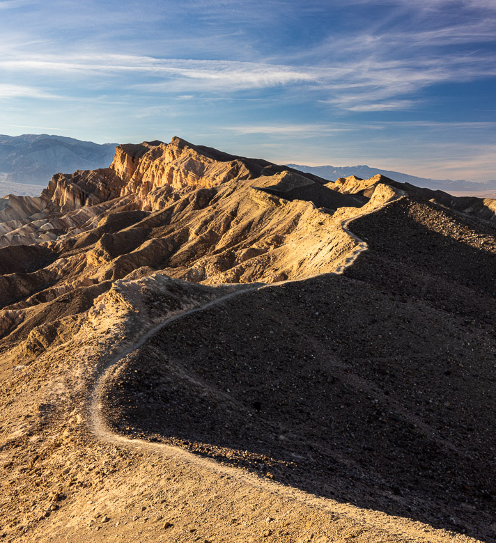
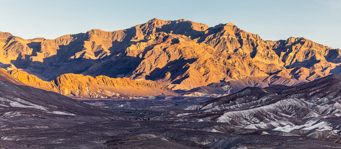
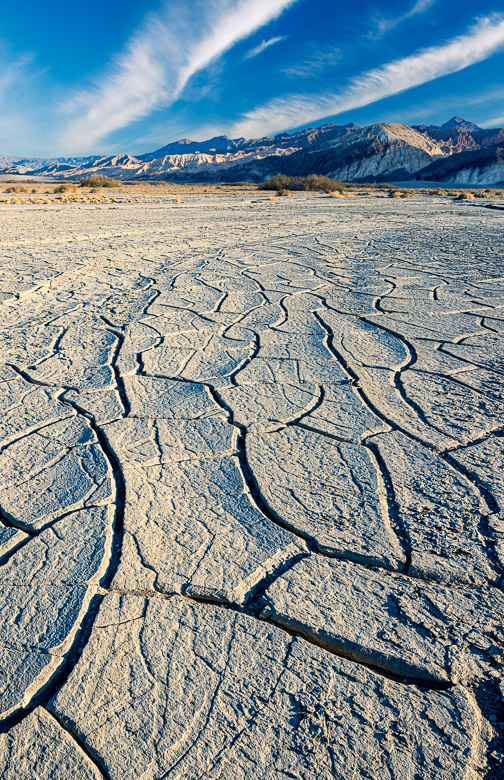
My first images are from a couple of different viewpoints, one on the east side of the valley and one on the west side overlooking the rift valley below. The mountain formations are quite weird, and the movement of the plates along the fault line means that the different colourful layers of sediment that build up the mountains are leaning in different directions adding to the attraction.
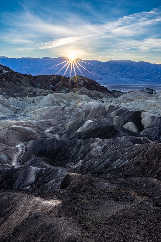
The very first image at the top of this post is captured at sunset. In the background you can see the flat basin floor of the Death Valley, the foreground is the Amargosa Mountain Range and the sun is setting over the Panamint Mountains.
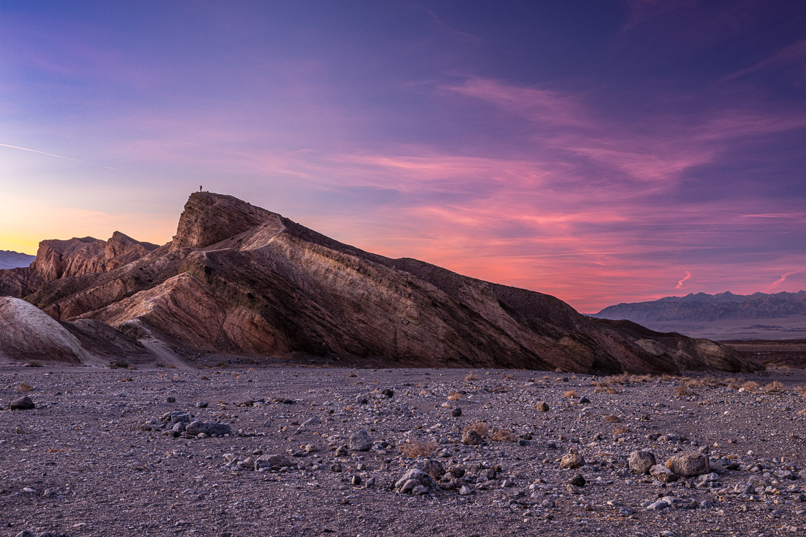
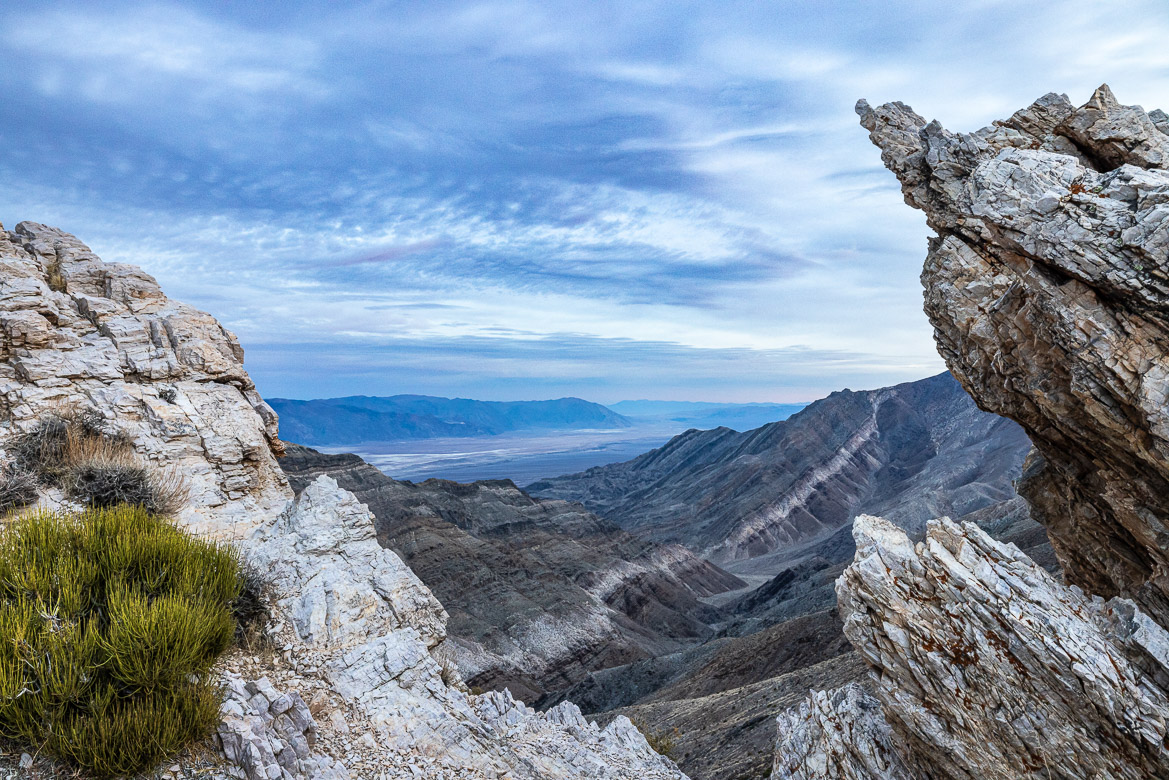
The next evening we ventured out to the western side of Death Valley climbing up with our cars to a viewpoint at the top of the Panamint Mountains. The road really demanded a 4×4. It was built by gold prospector and miner Pete Aguereberry to be able to reach what he saw as the most beautiful viewpoint in the Death Valley. But unfortunately, when we were there the sun was absent, but you can still see the valley floor with its salt flats, the Black Mountains behind and you see how the mountains have been uplifted and are tilted due to movements along the fault line.
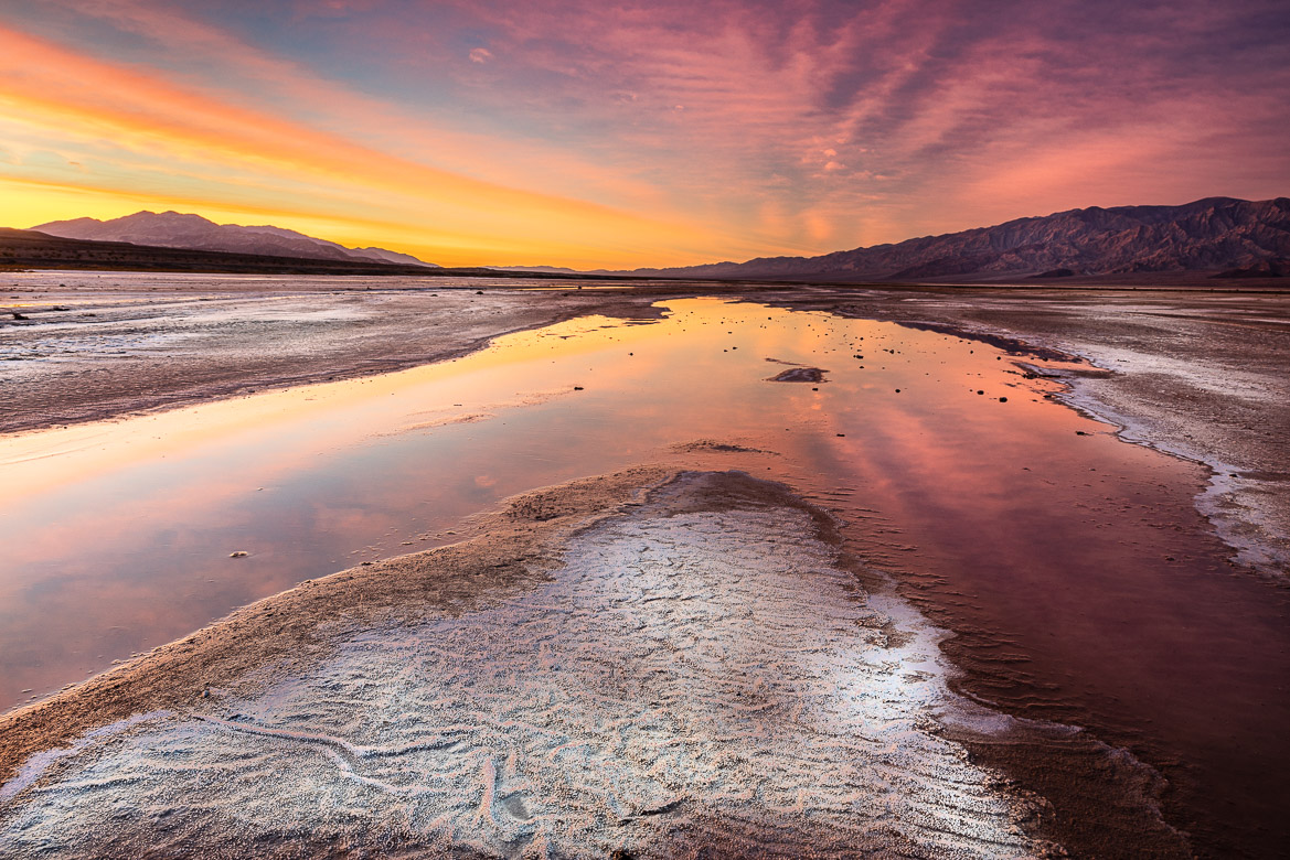
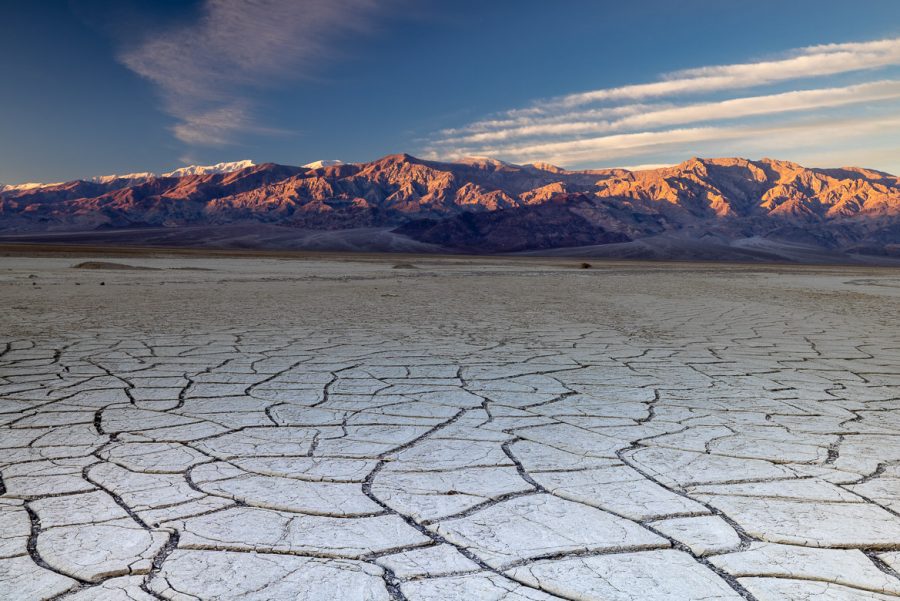
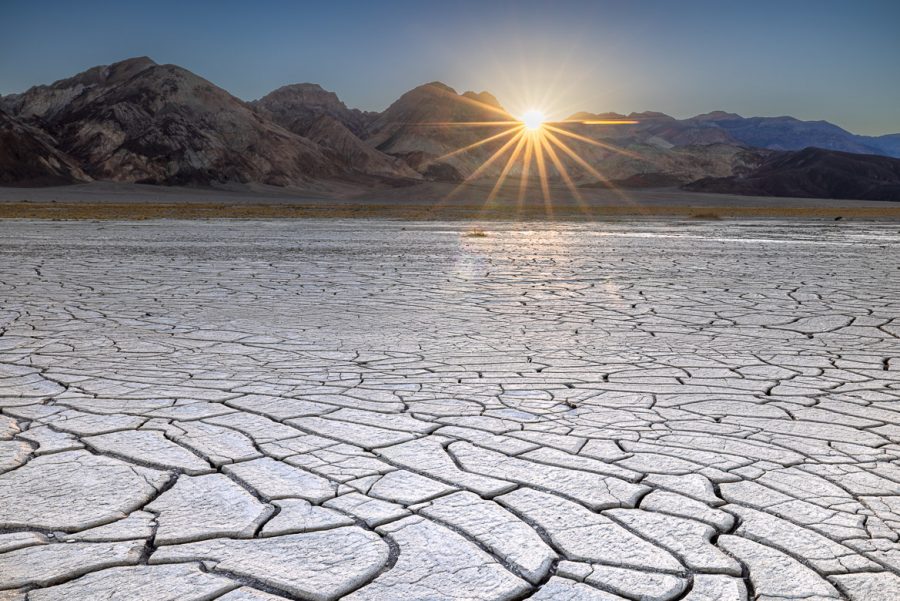
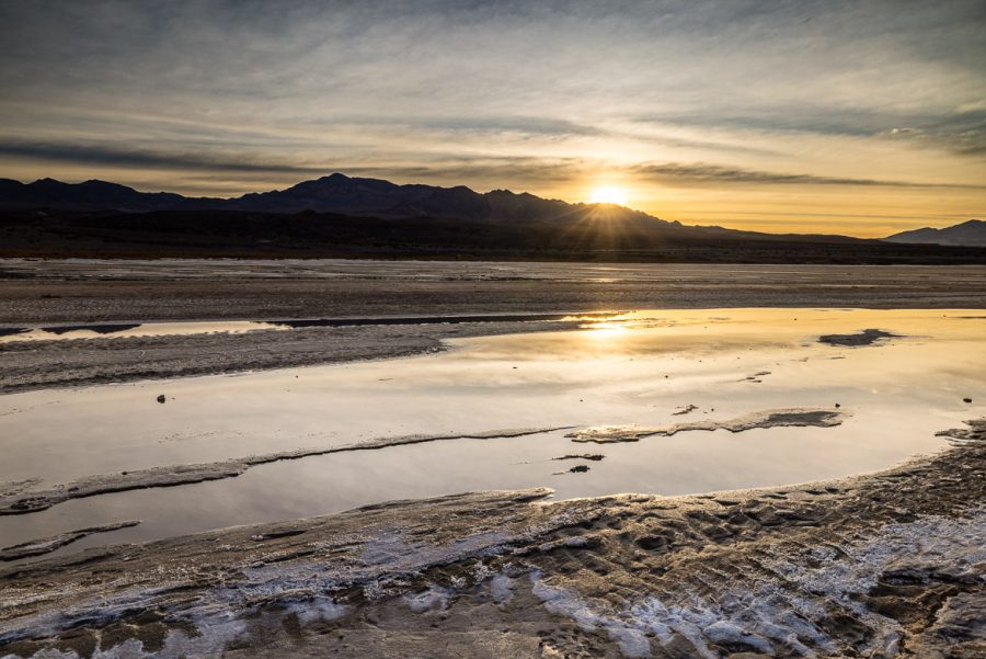
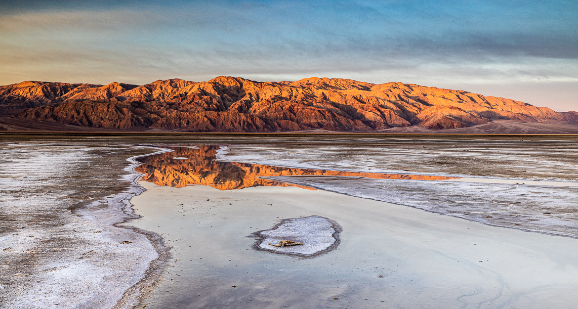
Salt Flats
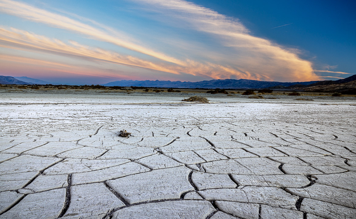
The bottom of the Death Valley floor was once filled with a lake, Lake Manly, which was 200 metres deep and covered the entire valley. As the lake couldn’t drain to the sea (it was below sea level) salt and other minerals were deposited at the bottom. Later in time, about 1,000 B.C. a much smaller lake again covered part of the valley and when the water evaporated the salt accumulated on the bottom and created the salt crusts mixed with mud that we now see in the valley.
The same phenomena takes place at other places below sea level. Dead Sea in Israel and Jordan is another example of a lake or sea below sea level with a strong salt content. River Jordan and other streams bring in minerals into the sea, water evaporates and the salt level increases more and more. The Dead Sea is the lowest place on earth at 400 metres compared to the Death Valley at 82 metres below sea level.
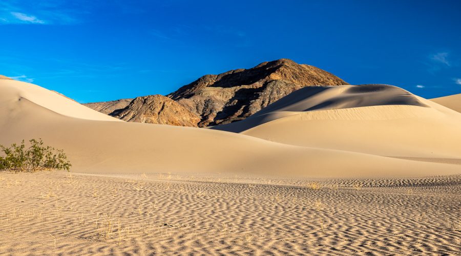
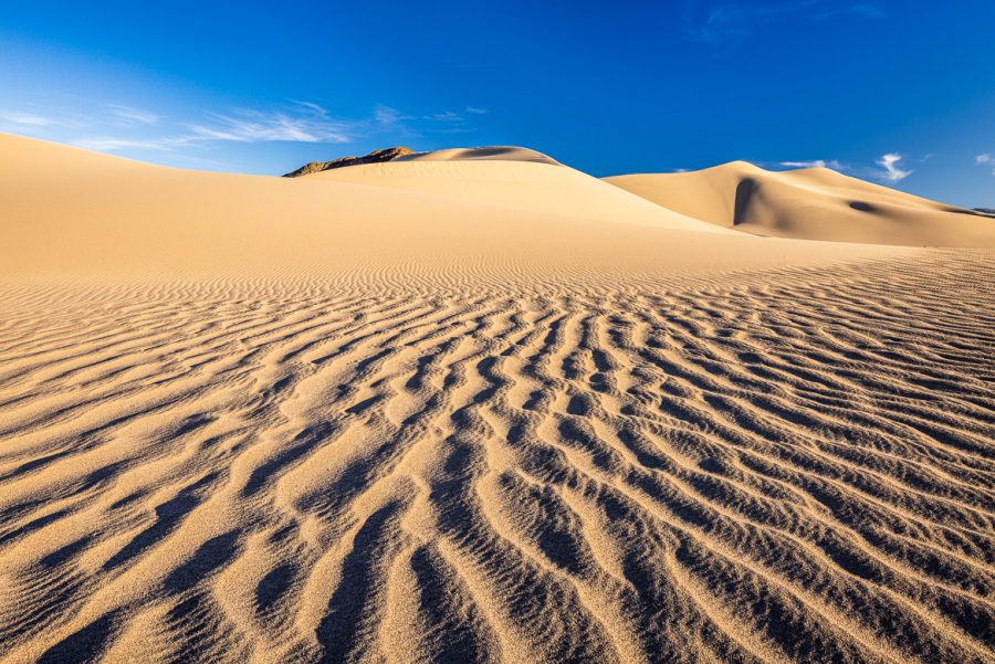
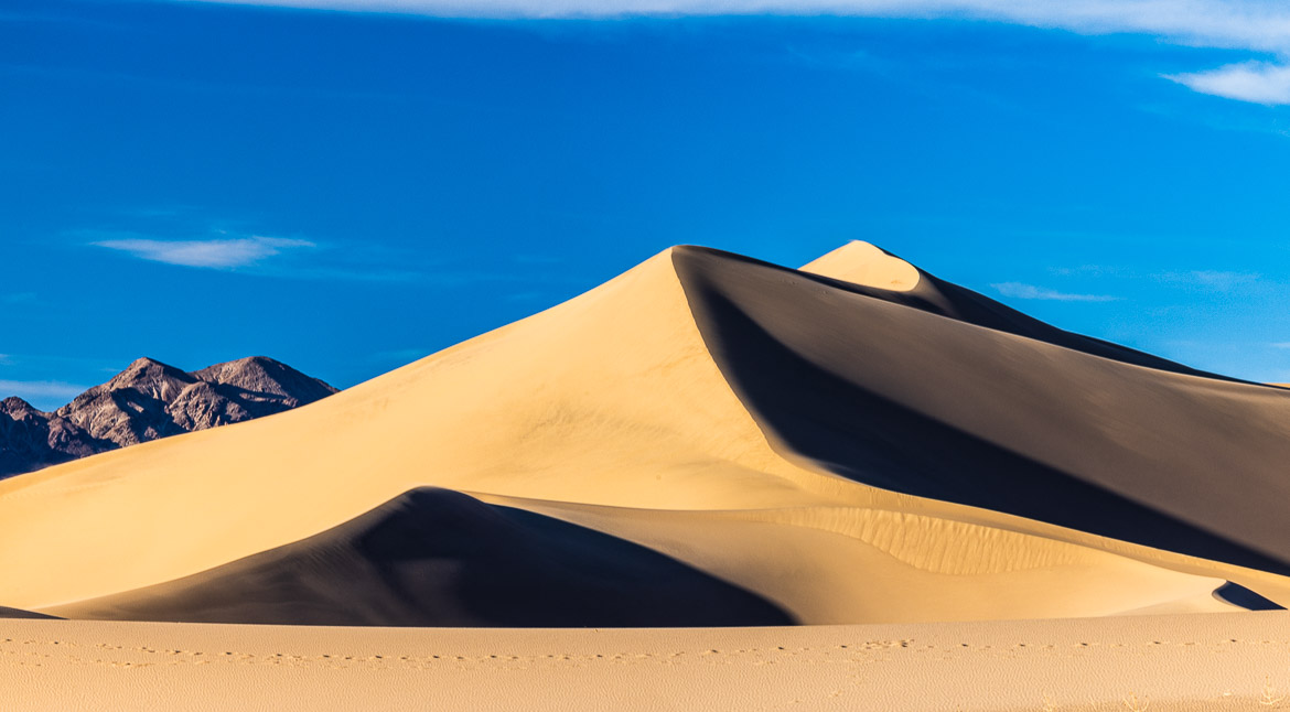
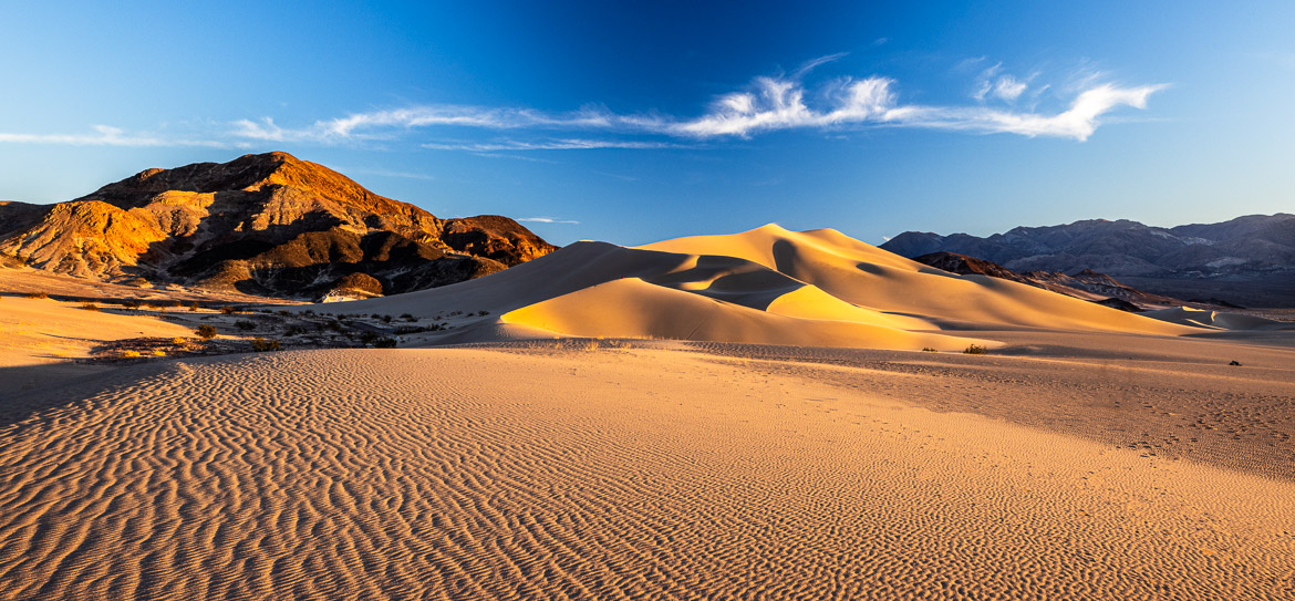
Sand Dunes
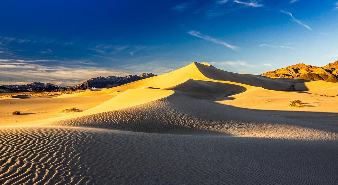
On a few places in or around the National Park sand dunes have developed. Although not of the size or vastness of the large deserts in the world, the juxtaposition of the dunes next to the mountains created some very attractive photo opportunities.